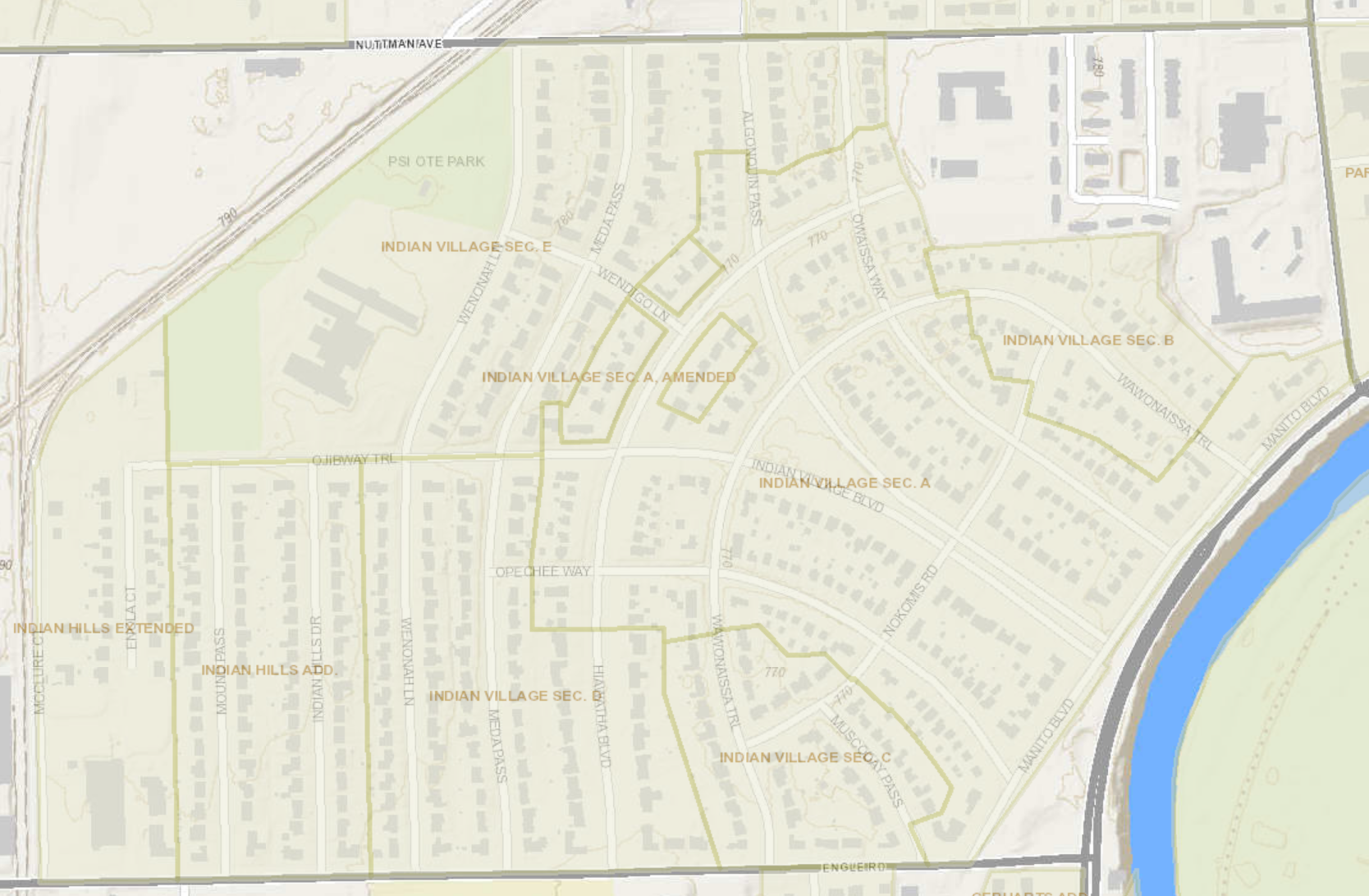
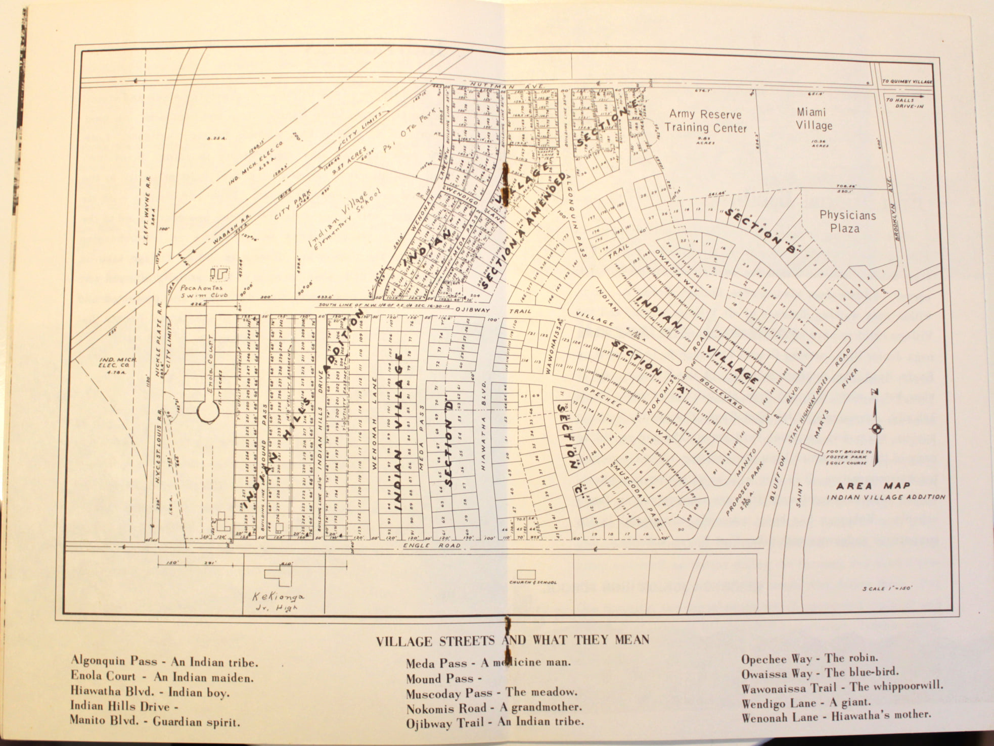
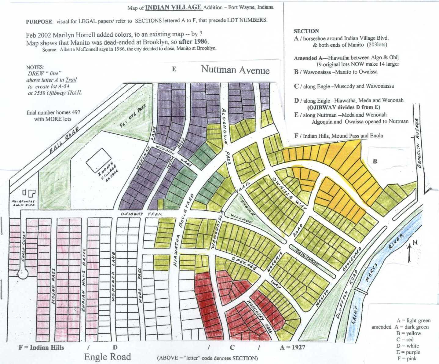
Neighborhood Map
Indian Village is located in the Waynedale area of southwest Fort Wayne, Indiana. The neighborhood is bounded roughly by Nuttman Avenue to the north, Bluffton Road to the east, Engle Road to the south, and the Norfolk Southern railroad right-of-way to the west.
Key Locations
| Location | Address |
|---|---|
| Entrance Monuments | Indian Village Blvd. at Bluffton Road |
| Indian Village Elementary School | 3835 Wenonah Lane |
| South Side High School | 3601 S. Calhoun Street |
| Pocahontas Swim Club (Poco Pool) | 3020 Ojibway Trail |
| Indian Village Park / Sears Pavilion | 1701 Bluffton Road |
| Psi Ote Park | Wenonah Lane at Nuttman Avenue |
| Foster Park (via footbridge) | Across the St. Mary’s River |
| Business Square | Hiawatha Blvd. at Opechee Way |
Plat and Parcel Maps
For detailed property-level maps, see the Documents page or these direct links:
Allen County Interactive Map
For property boundaries, ownership, and zoning information, use the Allen County Interactive Map (ACIMap).